Skype: neodalle-travel
Tel: +86 135 7447 2266
E-mail: sales@zhangjiajieholiday.com
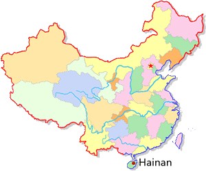
 Location map of Hainan
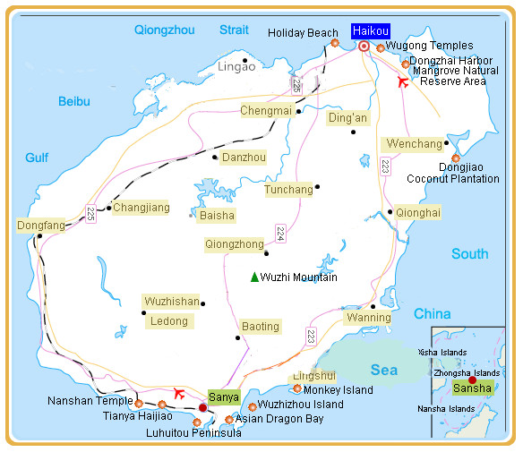
Hainan Tourism Map
 Belonging to the northern part of the tropics and virtually at the same latitude as Hawaii, it has a tropical monsoon climate and is known as the 'Eastern Hawaii'. Its average annual temperature is 23-25°C while the average temperature of the coldest February ranges between 16-20°C and the hottest August between 35-39°C. When northern China is snowy and icebound, local people are able to swim in the sea and enjoy the warm sunshine on the beach. In addition, the island has beautiful soft beaches and tropical scenery such as Holiday Beach, Dongzhai Harbor Mangrove Natural Reserve Area, Dongjiao Coconut Plantation, Asian Dragon Bay and Wuzhizhou Island. All these help to make the island a holiday hot spot in China, especially in winters and for newly-married couples. A special mention must be made here of the fact that since 2008, the government has been making a great effort to develop this tropical island province into an international tourism destination. On December 30, 2010, the first high-speed rail of the area, Hainan Eastern Ring Rail was put into service. Now people can travel easily between the northern point of the island (Haikou) and its southern point (Sanya) in just 1.5 hours. Another effort made by the government is the Tax refund policy carried out since January 1, 2011.
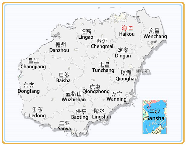
 Administration Division Map of Hainan
In Hainan, there are FOUR prefecture-level cities, FIVE county-level cities, FOUR counties, SIX minority autonomous counties and ONE economic development zone; at the grass-roots level, there are 183 towns, 21 villages, 18 sub-district offices.
Prefecture-level city: Haikou, Sanya, Sansha, Danzhou
County-level city: Wuzhishan, Wenchang, Qionghai, Wanning, Dongfang
County: Dingan, Tunchang, Chengmai, Lingao
Autonomous County: Baisha Li Autonomous County
Changjiang Li Autonomous County
Ledong Li Autonomous County
Lingshui Li Autonomous County
Baoting Li and Miao Autonomous County
Qiongzhong Li and Miao Autonomous County
 Ask Questions ?