Skype: neodalle-travel
Tel: +86 135 7447 2266
E-mail: sales@zhangjiajieholiday.com

Where is Zhangjiajie?
Zhangjiajie City is located between 28°52′-29°48′ north latitude and 109°40′-111°20′ east longitude. Lying in the northwestern part of Hunan Province, Zhangjiajie City is adjacent to Hubei Province in the north. The land area of Zhangjiajie City borders Shimen County and Taoyuan County to east , Yuanling County to south, Yongshun and Longshan County west, Hefeng County and Xuan'en County of Hubei Province to north.The total area of Zhangjiajie City is 9653 square kilometers, accounting for 4.5% of the area of Hunan Province.
Land Area of Zhangjiajie
With a maximum length of 167 kilometers from west to east and a maximum width of 96 kilometers from north to south, the total area of Zhangjiajie City is 9.653 square kilometers, accounting for 4.5% of the area of Hunan Province, as well as 0.01% of the land area of China.
Topography of Zhangjiajie
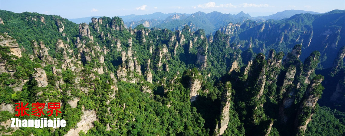
Zhangjiajie City is located at the junction of the Yungui Plateau Uplift and the Dongting Lake Settlement Area.The strata of Zhangjiajie City are complex and diverse to create a local landscape. There are mainly mountainous areas, karsts hills and caves, canyons and plains. The mountain area accounts for 76% of the total area. The most distinctive feature is the quartz sandstone peak landmark which is rare in the world. The city's terrain is high in the northwest and slopes southeast along the Lishui River.
The valley landscape is another outstanding performance in Zhangjiajie City. The valley landscape is formed due to the rise of the earth's crust, and also because the downward cutting effect of the stream is increased to make it too late to widen the river, and thus make the rivers create valley, canyon or gorge. The bottom of the river is extremely linear, with steep walls and flooded beaches.In Zhangjiajie City, the source of the Lishui River, the upper reaches of the Lushui River, and the section of Maoyan River are all the valley landscape.
Zhangjiajie Water Resources
There are lots of rivers in Zhangjiajie City. There are 212 rivers with a total area of more than 5 square kilometers in the city, including 48 first-class tributaries, 101 secondary tributaries, 54 third-level tributaries, and 8 fourth-level tributaries. Lishui River and Lou Shui River are major rivers in the area.
Lishui is one of the four major rivers in Hunan Province. It is located in the northwestern part of Hunan Province and covers the two provinces of Hunan and Hubei.The total length of the main stream is 407 kilometers, the drainage area is 18,496 square kilometers (15,736 square kilometers in Hunan), and the average annual runoff is 13.12 billion cubic meters. With 313 km ,Lishui River has its drainage area of 8135 square kilometers through Zhangjiajie City. Lishui River comes from Sangzhi County, with its three backbones of the south stream, the north Stream and the minddle stream. The North Stream is from Shanmujie in Sangzhi County, the South Stream is from Longjia Stockade in Yongshun County of Xiangxi Tujia & Miao Autonomous Prefecture, the Middle Stream is from the eastern of foot of Badagongshan Mountain in Sangzhi County. The three streams are meeting at Longjiangkou in Sangzhi County to float through Yongding District and Cili County of Zhangjiajie City, Shimen County and Lixian County of Changde City. Lishui River pours finally into Dongting Lake at Xiaodukou site in Lixian County of Changde City .
Loushui River , he largest tributary of Lishui River, is originally from Hefeng County in Hubei Province. With a total length of 250 km, It flows southeast through Sangzhi and Cili County to meet Lishui River at the downtown of City County. With its drainage area 2,565 square kilometers, Loushui River passes through the limstone mountain in Zhangjiajie. There are many deep valleys on both sides of the river , and the water like mirror.
 Zhangjiajie Biological Resources
 Ask Questions ?